Welcome to Ananthapuramu – The Gateway to Rayalaseema

Discover Ananthapuramu

Ananthapuramu, located in the southwestern part of Andhra Pradesh, is one of the most historically significant and culturally vibrant districts in the state. Known as the gateway to the Rayalaseema region, the district is celebrated for its rich heritage, ancient temples, majestic forts, and unique traditions that have been preserved for centuries.

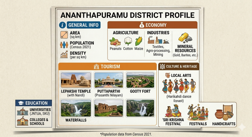
The district is home to several iconic landmarks, including the world-famous Lepakshi Temple, the historic Penukonda Fort, and the remarkable Thimmamma Marrimanu, one of the largest banyan trees in the world. Ananthapuramu also plays a vital role in the agricultural economy of Andhra Pradesh and is widely recognized for its groundnut cultivation and silk weaving industries.

With a blend of historical legacy, cultural richness, natural beauty, and modern development, Ananthapuramu offers visitors an unforgettable experience. From sacred pilgrimage sites and architectural marvels to bustling towns and vibrant local communities, the district stands as a symbol of resilience, tradition, and progress in the heart of Rayalaseema.Whether exploring its heritage landmarks, experiencing its colorful festivals, or enjoying its warm hospitality, every journey through Ananthapuramu leaves lasting memories. The district continues to preserve its rich traditions while embracing sustainable growth, making it a remarkable destination for visitors, pilgrims, and history enthusiasts alike.

District Overview

Ananthapuramu district, located in the Rayalaseema region of Andhra Pradesh, is one of the largest districts in the state and is renowned for its rich history, cultural heritage, and agricultural significance. The district was originally known as Anantapur, and its name is believed to have been derived from “Ananta Sagara”, a large tank constructed during the Vijayanagara period, with “Ananta” referring to Lord Vishnu and “Puram” meaning town. In 2022, the district was officially renamed Ananthapuramu in Telugu.The modern district traces its origins to 1882, when it was formed by separating areas from the Bellary district of the then Madras Presidency. Throughout history, the region was ruled by several dynasties, including the Mauryas, Satavahanas, Chalukyas, the Vijayanagara Empire, and later the British administration. Today, Ananthapuramu serves as an important administrative and commercial center in the Rayalaseema region.The district is widely known for its groundnut cultivation, making it one of the major agricultural regions in Andhra Pradesh. It is also famous for the Lepakshi Temple, renowned for its intricate Vijayanagara architecture and the giant monolithic Nandi statue. Other notable attractions include Thimmamma Marrimanu, recognized as one of the world’s largest banyan trees, and the historic Penukonda Fort, which once served as the second capital of the Vijayanagara Empire. With its blend of historical legacy, cultural traditions, and agricultural prominence, Ananthapuramu stands as a significant district contributing to the heritage and economy of Andhra Pradesh.

gemini generated image v7i83mv7i83mv7i8
gemini generated image k71s3ik71s3ik71s

History of Ananthapuramu

Ananthapuramu has a rich and fascinating history that dates back to ancient times. The district was ruled by several dynasties, including the Chalukyas, Hoysalas, and the Vijayanagara Empire, which played a significant role in shaping its cultural and architectural heritage. The region became an important center of administration, trade, and religion during the medieval period.

One of the most notable historical locations in the district is Penukonda, which served as the capital of the Vijayanagara Empire for a brief period after the fall of Hampi. Historical monuments such as Lepakshi Temple, Penukonda Fort, Gooty Fort, and Rayadurg Fort continue to reflect the district’s glorious past and architectural excellence.

During British rule, Ananthapuramu became part of the Madras Presidency and was officially formed as a separate district in 1882. Today, the district preserves its rich historical legacy while embracing modern development, making it an important cultural and historical destination in Andhra Pradesh.

Quick Facts In Ananthapuramu Distict

🗺️

Area

19,130 Sq. Km.

👥

Population

22.41 Lakhs

🗣️

Languages

Telugu, Urdu, Kannada

🌻

Known For

Groundnut, Silk & Solar Energy

Geography & Location

The Land of Vast Landscapes and Rich Heritage

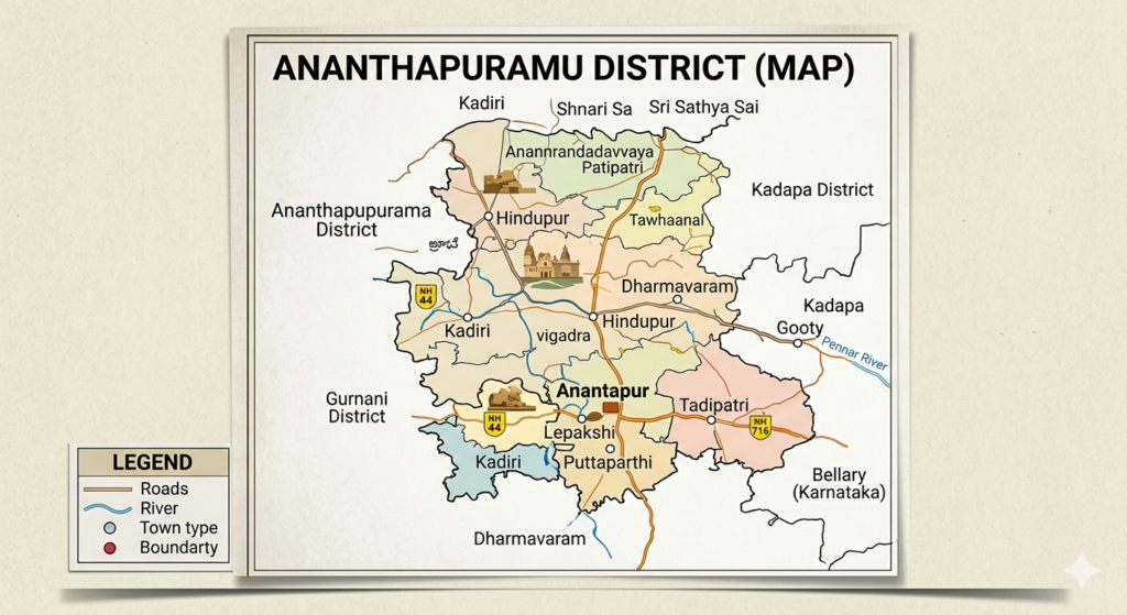
Ananthapuramu is located in the southwestern part of Andhra Pradesh and is one of the largest districts in the state by area. It forms an important part of the Rayalaseema region and shares its borders with Sri Sathya Sai District, YSR Kadapa District, Kurnool District, and the neighboring state of Karnataka. The district’s strategic location makes it an important gateway between Andhra Pradesh and Karnataka.

The district is characterized by vast plains, rocky terrains, scattered hills, and agricultural lands. The Penna River and its tributaries contribute to the region’s water resources and support agricultural activities. Ananthapuramu experiences a semi-arid climate with hot summers, moderate winters, and limited rainfall, making it one of the driest regions in Andhra Pradesh.

Despite its dry climate, the district is known for its natural beauty, unique landscapes, and rich agricultural heritage. Its geographical diversity, historical landmarks, and cultural significance make Ananthapuramu a remarkable destination in the Rayalaseema region.

Land Statistics & Measurements

icons8 ruler 48

Total Geographical Area

19,130 sq. km.

icons8 mountain 48

Elevation

335 meters above sea level

icons8 deciduous tree 48

Forest Area

2,764 sq. km

icons8 seedling 48

Agricultural Land

11,000+ sq. km

icons8 location 94

Region

Rayalaseema, Andhra Pradesh

Administrative Hierarchy of Ananthapuramu

Administrative Structure of Ananthapuramu

Ananthapuramu District is governed through a well-organized administrative system that ensures effective public service delivery and regional development. The district administration is headed by the District Collector and supported by various government departments responsible for implementing welfare programs, maintaining law and order, and promoting economic growth. For efficient governance, the district is divided into revenue divisions, mandals, municipalities, and gram panchayats, which work together to address the needs of both urban and rural communities. This administrative framework plays a crucial role in ensuring transparency, citizen welfare, infrastructure development, and sustainable progress across the district.

icons8 building 100

Revenue Divisions

Revenue Divisions ensure efficient administration, governance, and public service delivery across the district..

icons8 place marker 94

Mandals

Mandals facilitate local administration and ensure efficient delivery of government services.

icons8 seedling 64

Gram Panchayats

Gram Panchayats strengthen rural governance and support community development at the village level.
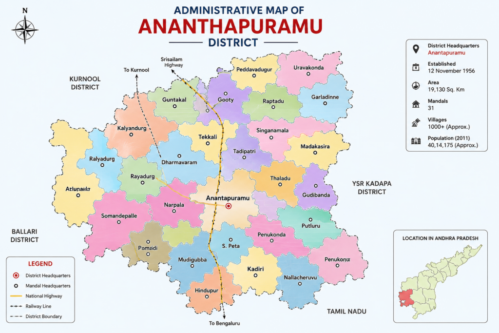

administrative map of ananthapuramu
0

Revenue Divisions

0

31 Mandals

0 +

Gram Panchayats

0 +

Villages

Culture & Traditions of Ananthapuramu

Heritage, Festivals & Living Traditions

Ananthapuramu is renowned for its rich cultural heritage and vibrant traditions that reflect the essence of the Rayalaseema region. The district celebrates a variety of festivals, religious events, and community gatherings with great enthusiasm, showcasing the strong cultural values of its people. Traditional music, folk arts, local customs, and spiritual practices continue to play an important role in daily life, preserving the district’s unique identity across generations.

Population & Demographics

Population

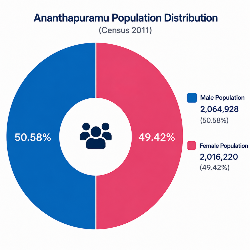
Ananthapuramu district is home to a diverse population with a balanced mix of urban and rural communities. The district reflects the cultural and social fabric of the Rayalaseema region, with Telugu being the primary language. Population distribution, literacy levels, and demographic characteristics play a vital role in the district’s overall development.

icons8 users 100

Total Population

4,081,148.

icons8 male user 48

Male Population

2,064,928

icons8 user female 48

Female Population

2,016,220

icons8 open book 94

Literacy Rate

63.57%

icons8 city buildings 100

Urban Population

1,139,539

icons8 home 94

Rural Population

2,941,609

pie chart image

Demographic Highlights

icons8 users 100

Total Population

4,081,148

icons8 male user 48

Male Population

2,064,928

icons8 user female 48

Female Population

2,016,220

icons8 open book 94

Literacy Rate

63.57%

icons8 city buildings 100

Urban Population

1,139,539

icons8 home 94

Rural Population

2,941,609

Major Towns of Ananthapuramu

Economy & Agriculture

Agricultural Heritage & Economic Development

Ananthapuramu district has an agriculture-based economy, with groundnut being the principal crop. Sunflower, cotton, paddy, and horticultural crops also contribute significantly to agricultural production. The district supports livestock farming and dairy activities, which provide additional income to rural communities. Besides agriculture, textile, cement, and small-scale industries play an important role in the economic development of the district, making Ananthapuramu a vital agricultural and industrial center of Andhra Pradesh.

Major Crops

Major Crops

Groundnut, sunflower, cotton, and paddy are the primary crops cultivated across the district.

background image

Agriculture

Agriculture

 Agriculture remains the backbone of Ananthapuramu's economy and supports rural livelihoods. 

background image

Industries

Industries

 Textile, cement, and food processing industries contribute significantly to economic growth.

background image

Livestock & Dairy

Livestock & Dairy

 Dairy farming and livestock activities provide additional income to farming communities.

background image

⚠️ WARNING: Be Alert! Severe weather conditions in your area.

Listings
News
Home
Jobs
Contact